Sunday, 29 September 2013

Negatives from first shoot.

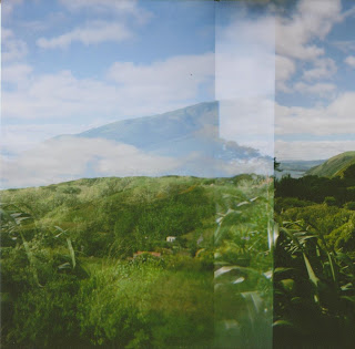
This is the negative from my first shoot. I was mainly experimenting and I like how these photos turned out. They all overlapped each other which I wasn't intending, but made quite a cool effect. But I brought 16 shot 120 film, so I was shooting with the arrow on 16 but I didn't have a mask so I think that that may have been my problem as to why they overlapped. 


This is the image that my project will be loosely based upon.
I may not use this image in my final presentation though as I may retake this image


Tuesday, 24 September 2013

Project Proposal and Precedents


Jim Goldburg, Open see, 2011.

The genre used here is documentary, realism, narrative and image manipulation.
The methods used here have been black and white photography. The image manipulation has been used here. This has been done by writing on the image, with scratching, and more than one vivid. Goldberg may have used film for this.

In the image below we see a portrait of a girl who is crying from the waist up. She is wearing cloth that covers her body and her head. There is a border around the photo that was drawn on the photograph with yellow vivid. Also written on the photograph with Red, Black and Blue vivid is the girls name, and a bit about her life. The words are written across the photo covering most of the photo, except on the girls face. The story is about her life, about how she is a refugee and has no place to go.

Jim Goldberg tells the stories of immigrants and refugees that have to leave their own country because of unlivable conditions such as war, disease and famine and their journeys to European countries.

I really like this work, its very raw and I like the way it tells the stories of the people, In its way it preserves them. In my work I want to take from this the way of preserving and telling the story of the houses and the people that have lived there.   


Duane Michaels, This is my proof, 1974,

Genre approach : documentary, idealist approach, narrative, fantasy.
Methods : Black and white film photographs, the photographs have been printed on and then the white space below the photograph has been written on.

In the photo below we see a black and white landscape photo. A couple is in the center bottom of the photograph sitting on a pier the Michael's has his hand around the shoulder of his girlfriend. His girlfriend has her head on his shoulder. They are surrounded by a lake. The photograph has a white border with a significantly big area at the bottom of the photograph where Michael's has written a short paragraph about his previous relationship.

The context of these photographs are about a relationship that has obviously broken up that had been a significant relationship in Michael's life. Michael's writing on the photograph expresses his feelings about how the current state of their relationship is nothing like it used to be and Michael feels he needs proof to prove that the relationship did happen.

I like the documentary perspective and the fact of the writing on the bottom of the photograph makes the intention of this work crystal clear.


Project Proposal - So this is my idea at the minute

With this lomography project I was thinking of taking pictures with the holga camera of houses and building that meant a lot to me. Buildings such as friends and relative's houses, place with emotional significance.

I want to take a documentary stand on my life. The building and homes which I spend my time at are of emotional significance. These are the places where I feel safe and I want to document those places and the essance of the people that live there that make those places important to me.

After I take the photos I will get them developed, put the negative on a light box and photograph it, I am then going to remedify them by negative scratching, or writing on the negative why these places are important to me or who the people are that live there. (I haven't quite figured out which yet.)

Out Put: For the out put I was thinking about making prints. Or putting the prints by the original site and rephotographing them with the people that I have scratched into the negative. 

Wednesday, 11 September 2013

First Shoot Lomo Project

So these photos are not the negatives, which I need to photograph, these are the scanned prints.
I am also missing 2 photographs which I will put up when I find them.


This is the Physical Hand in for my project.

I chose to do a mock counsel proposal that outlined the dangers of the road, the speeds of the traffic and the percentage of pedestrians that crossed the road.


These are the Final Set of Images for my project.

The statistics from NZTA that I have shown are that 92% of the cars speed, and the average speed of the cars.Also that the population of pkb is 1,722, 18% of Pkb use public transport and that 325 people cross the road daily.


These are my final survey images from the Pukerua Bay road.

50-53km


Between 1-1.30pm on the Pukerua Bay main road just north of the dairy 59 cars were traveling between 50 and 53km/h. Out of the 114 cars that were surveyed 51.75% were traveling between these speeds.


54-55km
22 Cars were traveling between 54km and 55km, this is 19.29% of the sample. and and 33 cars were traveling over 55km/h and this made up 28.94% of the sample. 


0ver 55km
 33 cars were traveling over 55km/h and this made up 28.94% of the sample

Overall 23 cars were driving 50km/h and under which means that 78.83% cars were driving over 50km/h.
This is an unacceptable amount and something needs to be done about it soon.


These are the contact sheets and some of the trial images for the Statistics shoot.


My final Project Proposal

Aim: My aim with this project is to put together a counsel proposal through photography that shows the state of the main road in Pukerua Bay, to show the speeding that occurs and the danger to the pedestrians that cross it.The speed limit of the main road that passes through Pukerua Bay is 50km, but hardly anyone drives at that limit as the speed before and after Pukerua Bay is 100km. The train station is across from the main road and so the people who live on the side without the train station have to cross the main highway to get to the train station.There is a bridge along Pukerua Bay but it adds another 10minutes to your journey.

Cars: I want to show that there is a significant percentage of cars that speed on that road. I will take photos of cars with the speed radar that shows the speed.
People: I want to show visually how many people walk across that road in a particular morning and the percentage of pukerua bay that use public transport.
I also want to show the time it takes if you were to walk over the bridge and some photos of the junction and establishing photos of Pukerua Bay.

Why: I'm doing this because crossing the main road every morning is extremely frustrating and dangerous.The main road and the people crossing it has been a community issue for many years. There has been some talk and meetings held but nothing practical has been done. I'm doing this because I want people to know the state of that road and I want something to be done about it.


Wednesday, 4 September 2013

Guideline for the selection of pedestrian facilities

So here is the Guideline for the selection of pedestrian facilities which I had a quick skim through. This basically has criteria for putting in place pedestrian facilities, which has how many people are crossing the road per hour to need.
I'm not too sure if I want to include this in my project though, the photo project is all about the collection of data and showing that data visually. So weather I also include and show visually the possible solutions for this in my project as well, I'm not too sure, I think that I have too many ideas for this project.

http://www.nzta.govt.nz/resources/pedestrian-planning-guide/docs/guidelines-selection-of-pedestrian-facilities.pdf

Tuesday, 3 September 2013

OK, so I have the statistics of how many people cross the road daily and I have the average speed of the cars from previous research done by transport NZ, I also have my own little survey.
What I need to do now is figure out how I'm going to visually present this information. I want to present this information in a way that promotes change, that will help people to understand the gravity of this situation.

Average Speeds of the cars.

"In the second half of 2007 a speed board was installed on the highway heading south at the
point where the road slopes down towards Centennial Highway. Transit New Zealand has
recorded speeds before the speed board was introduced and for three separate periods after it
was introduced.
The following figures summarise the information of recorded speeds before the speed board
was introduced and for a period in December 2007, when the speed board had been in
operation for three months.

Speeds recorded between 27 July 2007 and 3 August 2007 were as follows:
- Average Speed 58km/h
- 85%ile Speed 61km/h
- % above 92.44%

Speeds recorded post speed board installation between 4 December 2007 and 21 December
2007 were as follows:
- 1 Average Speed 57km/h
- 2 85%ile Speed 59km/h
Although the speed board seems to have had some impact, average speeds are still well above
the limit of 50km/h."

http://www.pukeruabay.org.nz/community/PukeruaBayNAP.pdf
Transit New Zealand, PowerPoint presentation

Pedestrians crossing the road.


"Two pedestrian surveys were undertaken by Transit New Zealand in 2004 for a continuous
2 hour morning and evening count to represent typical AM and PM weekday peak periods.
This survey also measured approximate waiting times, which ranged from 1 to 109 seconds,
with an average delay per pedestrian of 38 seconds. During the survey, observations were
made on the pedestrians crossing the highway, including 3 instances of pedestrians stuck
in the middle of the road, in one case for up to 66 seconds, and at least 3 observations of
vehicles sounding their horns and cases of braking by vehicles to avoid pedestrians crossing
the highway.
The survey result was extrapolated, using the weekly train timetable, and it was assessed
that 1006 train passengers were crossing the highway between Monday and Friday in the
peak hours and 377 non-train passengers with an additional 600 crossing in the weekday off
peak. The total volumes calculated for the weekend were 512, which total 2495 pedestrians
crossing the highway at this location during a 7 day week. This is an average daily pedestrian crossing number of 356 per day.
In the household survey undertaken in 2008 a number of respondents referred to how unsafe
they felt cycling or walking alongside SH1 particularly between Haunui Rd and preschool
facilities and shops."

http://www.pukeruabay.org.nz/community/PukeruaBayNAP.pdf

Walking to the over bridge.


Well, I walked the route you would take if you didn't cross the road directly and you walked over to the over bridge. It took roughly 9 minutes. For my 10min journey to the station it would add another 9min which would roughly make a 20min walk. You cut that journey in half by crossing the road at the dairy and not walking to the over bridge.
I took my camera with me to take pictures of the overbridge but when I got there I realised that I had left my SD card at home lol, so next time I will take some photos.

Sunday, 1 September 2013

Pukerua Bay Junction


This the problematic junction in Pukerua Bay.

Survey Shoot 2/9/13 1.00-1.30pm


Between 1.00-1.30pm the total cars that were photographed were 114. Total percentage of cars doing 54+ were 49%.

59 cars were photographed doing 50 and 53.
Overall the percentage of cars doing speeds between 50 and 53 were 51%


There were 22 cars doing speeds between 54-55.
The percentage of cars in this range was 19%


There were 33 cars doing speeds of 55+
The percentages of cars doing this speed was 28%